

— Judith Harvey, Senior IT Analyst, Plymouth Community Homes
Public Services, Without the Guesswork
Accessing a public service shouldn’t feel like solving a puzzle.
Woosmap helps agencies, housing groups, and councils surface relevant support options based on where people are and what they need.

Trusted by


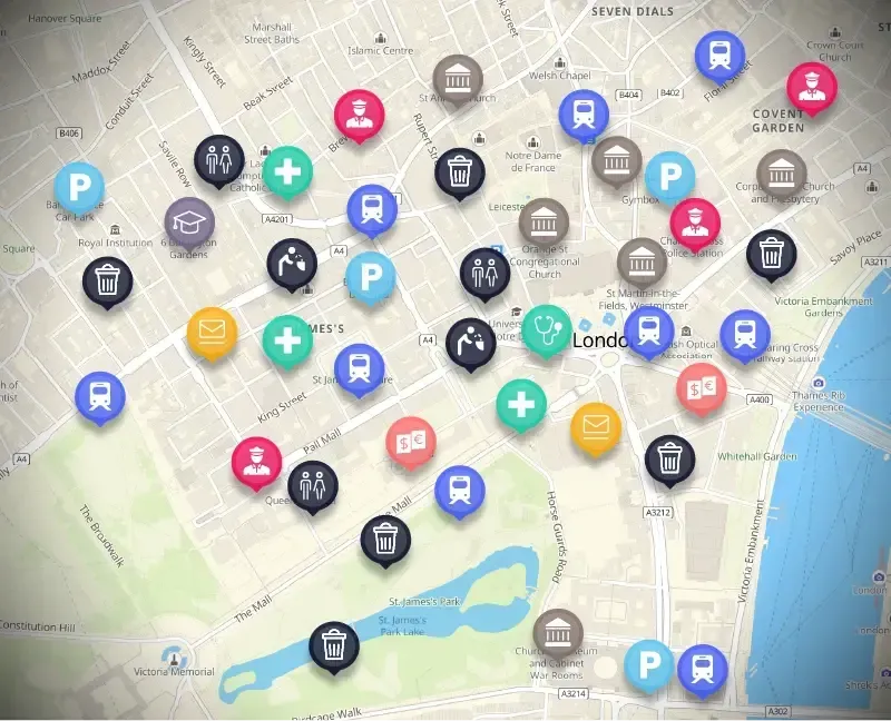
Map Services That Citizens Can Trust
Showcase service centers, collection zones, or support offices on a single, branded map.
Woosmap Map delivers smooth, zoomable views of local government services, with filters for accessibility, languages, or service types. Navigation becomes simpler — and public trust increases.
“We’ve improved the quality of applications and made it easier for customers and teams alike.”
“We’ve improved the quality of applications and made it easier for customers and teams alike.”
Keep Commuters Moving With Confidence
Delays, missed connections, and traffic can derail even the best public transit plans.
With dynamic updates and accurate service mapping, transport authorities can keep riders informed and in control.
These experiences are powered behind the scenes by Transit API, which feeds real-time routes, disruptions, and journey options directly into digital platforms.

Connect Residents With What’s Nearby
From recycling centers to housing applications, residents can search by location or eligibility, filter by accessibility or language, and navigate directly to the right location — powered by Stores API.
Location input is simplified, forms are pre-populated accurately, and access friction is reduced — especially for mobile-first users.

Smarter Collection for Cleaner Cities
In waste management, efficient routing makes a visible difference.
From household pickup to industrial zones, accurate address validation and zone-based planning help eliminate missed stops and delays.
Localities API underpins this logic, ensuring each collection route targets the right location at the right time.

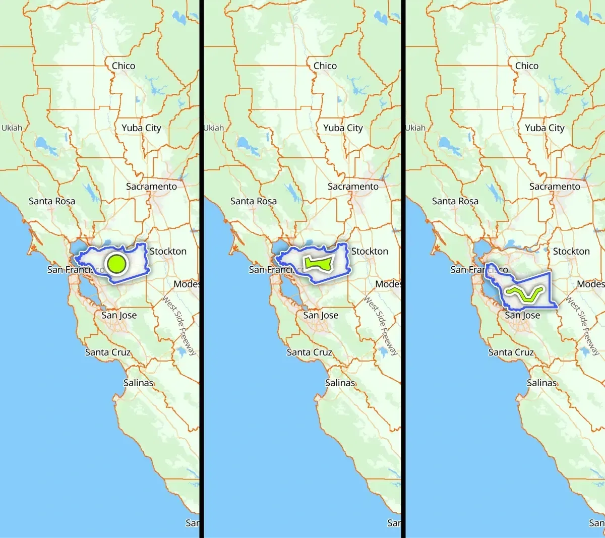
Streamline Public Data and Regional Rules
From postal districts to waste collection zones, Datasets API helps agencies manage spatial data at scale.
Use it to drive dynamic forms, filtered access, or service eligibility tied to geography — with minimal overhead.
Point Residents to the Right Office
Residents expect local, relevant results.
Woosmap enables AI chatbots to respond instantly with correct office locations and service access points — filtered by eligibility, geography, and hours.
